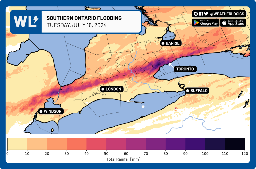
On July 16, 2024, Southern Ontario experienced flash flooding due to a series of strong thunderstorms. These storms produced over 100 mm of rainfall within a few hours.
Shortly after the storm ended, Weatherlogics swiftly created a rainfall accumulation map, illustrating the extent of the torrential rain. The map highlights the swath of extreme rainfall that stretched from the Ontario/Michigan border eastward through the City of Toronto.
To learn more about our severe weather data, click the button below:


